


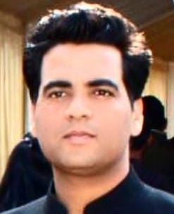
 JAMMU: In a monumental achievement that has brought immense relief to people worldwide, NIT Srinagar's Assistant Professor, Dr Vivek, has developed groundbreaking systems that provide advanced warning for landslides and earthquakes. Dr Vivek's tireless dedication to this project, working up to 10 hours per day, has resulted in a remarkable feat that promises to save lives and prevent catastrophic disasters.
In an exclusive online interview conducted by 'JK Monitor' (www.jkmonitor.org), led by Editor-in-Chief Ajmer Alam Wani, Dr Vivek shared comprehensive insights into the development and functionality of these cutting-edge systems. The interview shed light on the immense potential and impact of this breakthrough technology.
The new warning systems developed by Dr Vivek at NIT Srinagar offer a much-needed solution to the long-standing challenge of predicting and mitigating landslides and earthquakes. By harnessing the power of advanced algorithms and data analysis, the systems can detect and analyze key indicators of potential disasters, enabling authorities and individuals to take timely preventive measures.
The magnitude of Dr Vivek's accomplishment cannot be overstated. His unwavering dedication and perseverance in this highly challenging endeavor have yielded a significant leap forward in disaster management. The systems developed by him hold the potential to revolutionize the way we understand and respond to geological hazards, offering a lifeline to vulnerable regions across the globe.
The interview conducted by 'JK Monitor' provides a rare opportunity to delve into the technical aspects of Dr Vivek's breakthrough systems. His comprehensive responses to the questions posed shed light on the underlying science and methodology, offering a glimpse into the extensive research and expertise that went into their development.
This remarkable achievement by Dr Vivek at NIT Srinagar marks a turning point in our ability to forecast and mitigate the devastating effects of landslides and earthquakes. As the global community grapples with the growing impact of natural disasters, this breakthrough offers hope for a safer and more prepared future.
For more details and insights from the exclusive interview, read it below and immerse yourself in the groundbreaking work of Dr Vivek and the immense potential it holds for humanity. Dr Vivek gave in-depth reply to each related question asked.
Q.1 As you have bagged two patents on systems for prediction and prevention of landslides and detecting seismic activities and generating real time earthquake warnings, what purpose will patents serve and how will it benefit you, the institution and the nation?
Obtaining patents for systems related to landslide prediction and prevention, as well as earthquake detection and real-time warnings, serves several purposes and can bring multiple benefits to the inventor, the institution, and the nation:
1. Recognition and Protection: Patents provide legal recognition and protection for the inventor's innovative solutions. They establish exclusive rights, preventing others from using, making, or selling the patented inventions without permission. This recognition helps safeguard the inventor's intellectual property and promotes their work.
2. Commercialization and Revenue Generation: With patents in hand, the inventor or institution can commercialize the technology by licensing it to interested parties or establishing partnerships. This can lead to revenue generation through licensing fees, royalties, or collaborative ventures. The institution can reinvest these funds into further research and development, benefiting future projects and technological advancements.
3. Competitive Advantage: Patents confer a competitive advantage by granting exclusive rights to the inventor. This allows them to differentiate their technology from competitors, attract investors, and secure partnerships. Having patented systems for landslide prediction, prevention, earthquake detection, and real-time warnings can establish the inventor or institution as a leader in these fields, leading to increased credibility and opportunities.
4. Scientific Advancement: By patenting these systems, the inventor and institution contribute to the scientific community's knowledge base. The patented technologies can be shared through scientific publications, conferences, or collaborations, fostering further research and development in the field. This advancement benefits not only the inventor and institution but also the broader scientific community, promoting progress and innovation.
5. National Benefits: The nation as a whole benefits from these patented systems. Landslides and earthquakes can cause significant human and economic losses. The prediction and prevention systems can save lives and mitigate damages by providing early warnings and enabling proactive measures. Real-time earthquake warnings enhance preparedness and response capabilities, enabling prompt evacuation and emergency services. By reducing the impact of natural disasters, these patented systems contribute to national security, public safety, and resilience.
Q.2 How much time you took to develop these systems, was it an individual effort or a team work?
I dedicated my 1 year completely, working 10 hours per day, to develop the systems for landslide prediction, prevention, earthquake detection, and real-time warnings. Throughout the process, I considered various factors such as the complexity of the systems, available resources, research and development capabilities, and the expertise of the individuals involved. While it was primarily an individual effort, I received valuable support from my mentor, Dr. Rakesh Sehgal (Ex Director NIT Srinagar). His guidance and assistance played a crucial role in my development journey.
Q.3 How this innovative system and method will work and for a common man how beneficial is it?
For a common man, this innovative system and method can be highly beneficial in several ways:
- Early Warning and Preparedness: By providing advance warnings for landslides and earthquakes, individuals can have more time to prepare and take appropriate actions to protect themselves and their properties. This includes evacuating from vulnerable areas, securing belongings, and ensuring the safety of their families.
- Enhanced Safety: Real-time earthquake warnings enable people to quickly respond and find safe locations during seismic events. This can significantly reduce the risk of injury or casualties caused by collapsing structures, falling objects, or other hazards associated with earthquakes.
- Property Protection: With timely warnings, individuals can take preventive measures to safeguard their properties from landslides and minimize potential damages. This can include reinforcement of structures, slope stabilization, or relocation of vulnerable assets.
- Improved Emergency Response: The system's real-time warnings also benefit emergency response teams and authorities by providing them with vital information to mobilize resources, allocate personnel, and coordinate relief efforts effectively. This can lead to more efficient rescue operations and the timely delivery of aid to affected areas.
Q.4 Will this system require training to the manpower to operate it?
Yes, the operation of the system for landslide prediction, prevention, earthquake detection, and real-time warnings would typically require training for the manpower involved. Training is essential to ensure that the individuals responsible for operating and maintaining the system are equipped with the necessary knowledge and skills. The specific training requirements may vary depending on the complexity of the system and the roles of the personnel involved.
Some aspects of the training include:
System Familiarization: Training would involve providing a comprehensive understanding of the system's components, functionalities, and operational procedures. This includes familiarizing the operators with the hardware, software, data collection processes, and system interfaces.
Data Analysis and Interpretation: Operators would need training in data analysis techniques, including the interpretation of seismic data, geological data, weather patterns, and other relevant information. This training would enable them to effectively analyze and interpret the collected data to identify potential risks or detect seismic activities.
Emergency Response Protocols: Training would cover emergency response protocols and procedures to be followed upon receiving warnings or alerts. This includes understanding evacuation protocols, communication protocols with relevant authorities, and coordination with emergency response teams.
Maintenance and Troubleshooting: Personnel would require training in the routine maintenance and troubleshooting of the system to ensure its proper functioning. This includes equipment calibration, data quality checks, and addressing any technical issues that may arise.
Continuous Professional Development: Given the evolving nature of technology and scientific advancements, ongoing training and professional development would be necessary to keep the manpower updated with the latest methodologies, techniques, and system upgrades.
Q.5 How will it detect seismic activities and generate real time earthquake warnings, what will be the quantum of accuracy in detection?
The detection of seismic activities and the generation of real-time earthquake warnings in the system involve a combination of sensor networks, data analysis, and algorithms. Here's an overview of how it typically works:
Sensor Networks: The system utilizes a network of seismometers and sensors strategically placed in various locations. These sensors are designed to measure ground vibrations and seismic waves resulting from earthquakes.
Data Collection: The sensors continuously collect seismic data, capturing the movement and vibrations of the Earth's crust. The collected data includes the amplitude, frequency, and duration of seismic waves.
Data Analysis: The system applies advanced data analysis techniques to process and analyze the collected seismic data. This involves identifying specific patterns, characteristics, and anomalies associated with seismic activities.
Event Detection: By comparing the collected data with established thresholds or reference models, the system can detect seismic events. It distinguishes between normal background noise and the distinct signatures of earthquakes.
Real-time Warnings: Once a seismic event is detected, the system generates real-time earthquake warnings. These warnings can be based on the characteristics of the detected event, such as the magnitude, location, and estimated intensity. The warnings are then disseminated through various communication channels to reach the intended recipients promptly.
The quantum of accuracy in earthquake detection can vary based on several factors, including the sensitivity and quality of the sensors, the density and coverage of the sensor network, and the algorithms used for data analysis. In general, modern seismic monitoring systems strive for high accuracy in detecting earthquakes.
Accurate detection depends on the system's ability to distinguish between genuine seismic events and background noise or other sources of vibrations. Continuous improvements in sensor technology, data processing algorithms, and network infrastructure have contributed to increased accuracy in earthquake detection.
It's important to note that no system can achieve 100% accuracy in earthquake detection. However, advancements in technology and ongoing research aim to minimize false positives and enhance the reliability and accuracy of real-time earthquake warnings. The accuracy of the system's predictions and warnings would be periodically evaluated and validated against observed seismic events and ground truth data. Same is for the Landslide.
Q.6 As the Jammu and Kashmir UT is the land of frequent landslides especially along
Jammu Srinagar National Highway, will this help in solving this problem, if so how?
Yes, the innovative system for landslide prediction and prevention can play a significant role in addressing the problem of frequent landslides along the Jammu Srinagar National Highway in the Union Territory of Jammu and Kashmir. Here's how it can help:
Early Warning and Preparedness: The system integrates various data sources such as weather patterns, soil composition, and topography to identify areas at risk of landslides. By analyzing these data in real-time, the system can provide early warnings for potential landslides along the highway. This allows authorities and local communities to be prepared and take preventive measures in advance, such as implementing evacuation plans, diverting traffic, or temporarily closing vulnerable sections of the highway.
Monitoring and Alert Systems: The system can incorporate monitoring mechanisms along the highway, such as sensors to measure ground movements and slope stability. This continuous monitoring enables the system to detect any changes or anomalies that could indicate an imminent landslide. Alerts can be generated and communicated to relevant stakeholders, allowing for prompt actions to be taken, including evacuation of at-risk areas and rerouting of traffic.
Geotechnical Assessments: The system can facilitate ongoing geotechnical assessments of the slopes along the Jammu Srinagar National Highway. By analyzing data related to soil properties, slope stability, and historical landslide occurrences, the system can help identify vulnerable areas and prioritize mitigation measures. This information can guide engineers and geologists in implementing engineering solutions such as slope stabilization techniques, protective measures, and controlled blasting, reducing the likelihood of landslides.
Decision Support System: The system can serve as a decision support tool for infrastructure planning and management. By providing real-time information on landslide risks and historical trends, it can help authorities in making informed decisions regarding road design, alignment, and construction techniques. This ensures that future infrastructure projects consider the geotechnical aspects and take appropriate measures to minimize landslide susceptibility.
Overall, the system's early warning capabilities, monitoring systems, geotechnical assessments, and decision support functions can contribute to mitigating the problem of frequent landslides along the Jammu Srinagar National Highway. By enabling proactive measures, timely response, and informed decision-making, the system can help reduce the impact of landslides, improve safety, and enhance the resilience of the highway infrastructure.
Q.7 What is the mechanism that promises to effectively mitigate landslides?
The mechanism for effectively mitigating landslides involves a combination of preventive measures and early warning systems. Here are some key components of the mechanism:
Geological and Geotechnical Assessments: Conducting comprehensive geological and geotechnical assessments of landslide-prone areas is crucial. This involves studying the geological characteristics, soil properties, slope stability, and historical landslide occurrences. By understanding the factors contributing to landslides, engineers and geologists can identify vulnerable areas and develop appropriate mitigation strategies.
Slope Stabilization Techniques: Implementing slope stabilization techniques are vital to prevent landslides. These techniques can include the use of retaining walls, slope reinforcement with geosynthetics or soil nails, soil bioengineering measures (such as planting vegetation), and terracing. These methods aim to improve slope stability, reduce erosion, and enhance the overall resistance of the slopes to sliding.
Drainage and Erosion Control: Proper drainage systems play a crucial role in mitigating landslides. Ensuring effective surface and subsurface drainage helps manage water infiltration and reduces the buildup of excess pore pressure within the slopes. Additionally, erosion control measures, such as erosion-resistant vegetation, erosion control blankets, and sediment retention structures, help prevent soil erosion and maintain slope stability.
Early Warning Systems: Implementing early warning systems for landslides is crucial for timely evacuation and preventive actions. These systems integrate various data sources, including rainfall intensity, soil moisture levels, ground movements, and other relevant parameters. By continuously monitoring these data, the system can detect changes or precursors to landslides and issue real-time warnings, allowing for proactive measures to be taken to safeguard lives and infrastructure.
Public Awareness and Preparedness: Educating and raising public awareness about landslides, their causes, and the importance of preparedness is essential. This includes disseminating information about warning signs, evacuation routes, and safety measures. By promoting a culture of preparedness, individuals and communities can take necessary precautions and respond appropriately in the event of a landslide warning.
The effectiveness of landslide mitigation measures relies on a combination of these components, tailored to the specific geological and environmental conditions of each area. Implementing a comprehensive and multi-disciplinary approach that combines engineering solutions, monitoring systems, and public engagement is crucial to effectively mitigate landslides and minimize their impact.
Q.8 As the traditional methods of landslide prevention have limitations, does this too have some limitations?
Yes, while the innovative system for landslide prediction and prevention offers significant advantages, it also has certain limitations that should be considered. Some of the limitations include:
Data Availability and Quality: The accuracy and effectiveness of the system heavily rely on the availability and quality of data. Insufficient or incomplete data, particularly in remote or inaccessible areas, can limit the system's ability to accurately predict and prevent landslides. Data collection and maintenance challenges can impact the reliability of the system's predictions.
Cost and Infrastructure Requirements: Implementing and maintaining the system can involve substantial costs, including the installation and maintenance of sensor networks, data collection systems, and the infrastructure required for real-time monitoring and warnings. These costs may pose challenges, especially in areas with limited resources and infrastructure.
False Positives and False Negatives: Like any prediction system, there is a possibility of false positives (predicting a landslide that does not occur) and false negatives (failing to predict a landslide that does occur). Achieving a balance between accurate predictions and minimizing false alarms can be challenging and requires ongoing refinement of algorithms and data analysis techniques.
Q.9 What are the projects, innovations you would like to focus in near future?
In the field of pavement and geotechnical engineering, there are several projects and innovations that hold promise for the near future and I want to work on the same like Sustainable and Resilient Pavement Materials, Smart Pavements and Intelligent Transportation Systems, Geotechnical Site Characterization and Risk Assessment, Soil Stabilization and Ground Improvement
Q.10 What advice you would like to give to budding researchers and on which areas they should focus to develop systems which will benefit common people more and more?
To budding researchers, I would offer the following advice on areas to focus on in order to develop systems that benefit common people:
1. Address Real-World Challenges
2. Human-Centered Design
3. Collaborate and Seek Diverse Perspectives:
4. Sustainability and Social Impact
Q.11 Your success credit goes to whom?
My family, consisting of my parents, sister, and my wife, Dr. Anita, an Assistant Professor of Botany at a degree college in Sarkaghat (Himachal Pradesh), has been instrumental in supporting my research journey. I am grateful to my wife for her unwavering support and understanding. She stands by me through thick and thin, comprehending my aspirations and challenges. Additionally, my 2.5-year-old son, Rigved Chauhan, serves as a constant source of motivation. I envision him drawing inspiration from my work as he grows, instilling in him the value of contributing to society.
I would like to acknowledge the immense contribution of Dr. Rakesh Sehgal, the former director of NIT Srinagar, presently a HAG Professor in the Mechanical Engineering branch at NIT Hamirpur who has been a guiding force and mentor to me. He has consistently demonstrated excellence in every task, and his proficiency serves as an inspiration. I am deeply grateful to him for his invaluable support in obtaining these patents. Without his guidance and encouragement, I would not have been able to achieve this level of research success.
Q.12 Tell me about some person who inspired you a lot professionally
In the realm of research, my journey was initiated under the benevolent guidance of Dr. Pradeep Kumar, an Associate Professor (Civil) at NIT Hamirpur. His unwavering belief in my capabilities and the opportunity he provided by selecting me as a Ph.D. candidate opened doors of possibilities. Since 2016, he has consistently supported and assisted me in every step of my research expedition. His faith in my potential has been a driving force, propelling me forward.
During that transformative period, Dr. Vijay Shankar, Associate Professor (Civil) at NIT Hamirpur the esteemed Head of the Civil Engineering Department, also played a crucial role in my development. His valuable guidance and encouragement have been instrumental in shaping my journey.
Among the remarkable individuals who have significantly influenced my path, I cannot overlook the impactful contributions of Dr. Raman Parthi and Dr. R. K. Dutta, esteemed professors at NIT Hamirpur. Of particular significance is my journey alongside Dr. R. K. Dutta, whose profound teachings have left an indelible mark on my professional growth. Though his support was indirect, he empowered me with the tools and knowledge to navigate challenges independently. Our shared approach, characterized by meticulous attention to detail and adherence to schedules, has resonated deeply with me. I am very thankful to Dr. Shafi Mir, Professor NIT Srinagar (Civil) for guiding me.
However, I must emphasize the paramount influence of Dr. Rakesh Sehgal, the former Director of NIT Srinagar and presently a distinguished professor in the Mechanical Engineering branch at NIT Hamirpur. Dr. Sehgal understands of my potential, unwavering support, and mentorship have shaped not only my career but also my character. His guidance has propelled me to explore every facet of my potential. Dr. Sehgal epitomizes the qualities I admire and aspire to embody, as he has played a pivotal role in my personal growth, making me strive to become a better human being. He is always like parents to me.
Q.13 Apart from the individuals you have already mentioned, who are the other people from your life experiences whom you would like to remember and hold dear in your heart?
On this momentous occasion, I wish to pay homage to the illustrious Dr. S.P. Guleria, my esteemed former Director, whose vision and leadership have left an indelible mark on my journey. It is with deep appreciation that I remember the all faculty and administration of my previous job at JNGEC Sundernagar, Himachal Pradesh. Their collective wisdom, dedication, and unwavering support have played a pivotal role in my professional growth. In particular, I hold a special remembrance for the extraordinary team of faculty in the Department of Civil Engineering at JNGEC Sundernagar, Himachal Pradesh, with whom I had the privilege of working closely.
As I reflect upon this day, I am filled with gratitude for the remarkable individuals who have played an integral role in my professional and personal development. Their beliefs in my abilities, their mentorship, and their unwavering support have paved the way for my accomplishments. Their presence in my life is a testament to the power of guidance and collaboration, and I am truly blessed to have had them as a part of my journey.